aus Tradition & Lebensfreunde
The connected hill ‘Bückeberg’ is excellent for hiking and walking tours – quite equal if you just would like to make a short walk or you prefer a long-distance hike. All ways are well signed and we’ll give you additional information about ‘where to go’.
You might have the choice to reach the limits of the forest by car (5-10 Min), bike (uphill) or by foot. (20-30 min)
If you would have any question about possible tours pls do not hesitate to keep in touch – we would be lucky to support you with our local knowledge.
Also, the hiking trails of the hill Bückeburg are linked to the connected hills – so long-distance hikes up to 30km are possible – and you might be able to take a train back after finishing the tour or the other way around to start by train and to return by foot.
By using your car you would have a broad variety of possibilities to hike and walk in the hills of the region – and also around the lake Steinhuder Meer, the Mid Land Chanel and the River Weser.
Listed below you’ll find some of our personal favourites:
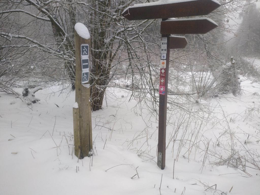
#1 Brandshof - Sandstone Quarry
Depending on condition and breaks: 2,5-5 hours
The tour could be started at the holiday flat (would add about +1h) or via car arrival on ‘Brands Hof’ what would need about 5 min from the vacation apartment.
Starting at the Brands Hof shelter the way would start right hand from the shelter just along the limits of the disused quarry. The way is called ‘Grenzweg’. The ‘Grenzweg’ is starting as you can see on the picture above in u-shape – but it changes just behind the quarry limits as a small foot path. Arriving at a junction with a bigger trail – just cross this way and follow the path on the other side passing through the thicket. It’s about 30 min + if you’ll arrive at another bigger forest road. Just keep some meters to the left and then follow again the path on the other side until you arrive on top of another disused quarry. Here you can walk town – best case following the tracks in the mud to reach the bottom of this old quarry – where you’ll find nice places for a stopover. Following the foot path to the south on the bottom of the quarry – you’ll walk along the quarry through a dark and spooky forest – until you reach old buildings – what you pass through on the right-hand side while you are leaving the quarry area. Reaching the next forest road – tun right about 400m where you’ll find an observation platform for more than 2’000 Dino footprints within the sandstones of the used quarry. The way back starts on the opposite side of the observation desk – downhill. So just use the 2nd forest road crossing to turn left to ‘Brandshof’. Reaching the pond a while later turn right along the creek and you’ll reach the starting point quickly.
You would be able to combine this hike with #2 and #3
#2 Nature Adventure trail
Depending on your condition about 60 – 90 minutes
Starting point: Shelter Birkenhöhe
Needed condition: easy hike – mostly on small forest trails or roads.
If you arrive by car, you can park your car at the end of the road going to the shelter Birkenhöhe. If you would like to hike from the vacation apartment – add about 1h – 1,5h depending on the way you choose and your condition.
The Nature Adventure trail (‘Natur Erlebnispfad’) is passing through the bottom of a disused quarry. Three wild horses are living in the quarry to keep the bushes and the grass short due lots of rare amphibians are living in the mud and water holes of the quarry.
Also display boards are explaining some information about the trail and the quarry.
Arriving the entrance area of the quarry on the right hands side a forest trail is going uphill – so you would be able to reach the upper edge of the quarry. Following this forest path along the quarry edge you’ll reach the shelter ‘Brands Hof’. Here you turn right also along the edge of the quarry by using the ‘Grenzweg’ until you reach the next crossing with a forest road. Here you turn right until you’ll find a while later a forest trail going downhill back to the shelter Birkenhöhe again.
#3 Sextons way and forrest edge
Nice hike – duration about 1,5 bis 2,5 hours – depending on your condition
3/5 pedestrians along calm local streets
2/5 forest or farm trails
Leaving the house, you’ll walk the ‘Sülbecker Straße’ uphill until the end. At the crossing turn uphill. You can use the cross light to cross the national road – or the tiny way right after the gardener’s shop – where you’ll find a crossing without cross lights (pls. keep care!). Walking uphill – passing through the church on the left-hand side, you’ll find the ‘Küsters way’. Following the Küsters way uphill it will change to a farmer’s way after few meters. Arriving on the top at the crossing with ‘Liekweger Strasse’ just turn left and cross the street at ‘Erlenweg’ to continue walking uphill. At the curve on the top of the Erlenweg – turn left by using the forest trail. Here it could be muddy – so pls take care about slippy conditions. After about 400m at the next crossing turn left to follow the foot path along the edge of the Bückeburg forest until you reach ‘Liekwegen Sportplatz’ what is the local sports arena. There you’ll find on the opposite side of the street a nice viewing point what you can use for a stopover. The way back is easy – following the street downhill – crossing the ‘Liekweger Strasse’ and following the Hüttenweg and Hüttenstrasse until you reach Obernstrasse, where you turn left. At the end just go downhill – and use at the crossing ‘Mühlengrund’ to arrive again at the federal highway what you can cross at the cross lights. Following Ostpreussenstrasse you’ll be back at your starting point.
20 minutes short hike
A small round through the fields
The so called ‘Farmhouse round’ is just a short walk just to get 20 minutes of fresh air. Leaving the flat – just walk downhill. In front of the farmers house – about 500m downhill – turn left into the farmers road. Walk about 200m – than again turn left. At the next crossing just turn uphill again – where you’ll arrive at ‘Sülbecker Strasse’. Turning left again and you’ll be back after about 100m at Großer Kamp 2. Depending on the weather parts of the way could be muddy.
90 minutes of fresh air hike
Another tour is just starting in front of the house would take about 90 minutes – depending on your condition.
Walking downhill ‘Großer Kamp’ until the end – there turn left into the party gravelled farmer’s road. Arriving in the crossing at the paved farm road turn right until the curve – where you turn left again in the grassy famer’s road passing through the fields. At the next crossing turn left again – walking through the tiny forest with the creek crossing the way and afterwards uphill – to reach the paved farm road again. There turn left. After passing through the houses a few 100 meters more you’ll find another grassy farm road – going back to ‘Großer Kamp’ if you follow. If you reach ‘Großer Kamp’ at the farmers house with the Lama enclosure – just turn uphill and you’ll be back after another few minutes.
Weser river & "Willhelm Monument"
About a 20 minutes car ride away the river Weser has broken through the Weser hills in the history. A huge monument showing Willhelm the Emperor is located on the west bank of the river in the mountain and you’ll find a restaurant at the monument and a tiny exhibition about the history of the monument and Willhelm the emperor. From the terrace and the Restaurant you’ll have a marvellous view over the river valley. Depending on the weather and the timing (weekend, public holidays etc.) it might be crowded around the monument. Hiking trails are starting and ending at the monument passing through the western hills.
At the east bank it is much calmer and it is minimum as nice as at the more crowded west bank. Around the television tower at the top you’ll find sufficient parking space. On Saturdays, Sundays and at public holidays you are able to climb on the lower platform of the television tower what enables you an marvellous view around the river Weser valley (south east), into the northern lowlands of Lower Saxony (north) and East Westphalia / Lippe (south west). If the Tower is opened a kiosk served by local volunteers serves homemade cake, hot and cold drinks ice cream etc. and you can seat under the trees in front of the tower with other locals and hikers & bikers.
Starting from the tower you can make a about 15min hike along the ridge until you’ll reach the ‘Porta Pulpit’ on top of the cliffs with a great view over the River Weser ‘great curve’ and the opposite hill with the monument. Also various shorter and longer hikes are possible starting at the television tower – just ask us and let us know your demands so we can recommend you trips between 2km and 30km.
